Quebec under ‘veille orange – tornade’ as severe storms loom Tuesday
Quebec faces a 'veille orange - tornade' with violent thunderstorms and possible tornadoes expected Tuesday, as weather alerts spread across several regions.
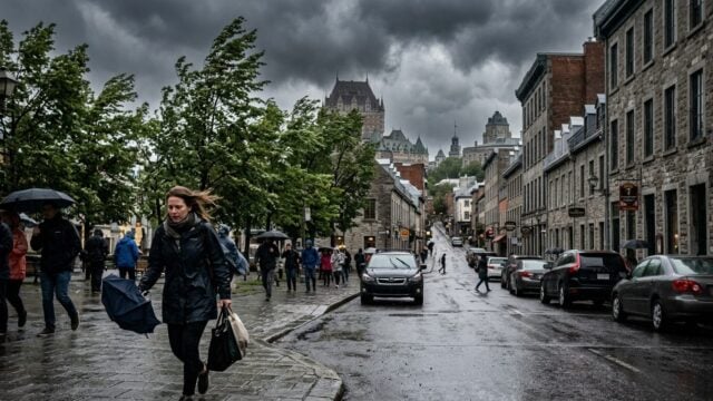
QUEBEC CITY — Quebec is under a veille orange - tornade as forecasters warn of violent thunderstorms and possible tornadoes Tuesday, raising the risk of damaging winds, large hail and sudden power outages across several parts of the province.
The alert matters far beyond one bad-weather day. Roads, schools, outdoor work sites and evening travel can all be disrupted fast when storms turn severe, and emergency crews often face a short window to respond.
MétéoMédia said the province faces a high risk of severe weather, with tornado watches and severe thunderstorm warnings in force for multiple sectors of Quebec. The warning covers a broad area, not a single isolated corridor.
Storm risk rises fast
Forecasters are watching a setup that can change quickly. Warm, unstable air and enough wind shear can help storms organize into dangerous cells, and that is when the threat of rotating storms and tornadoes becomes more serious.
That combination is what makes Tuesday different from an ordinary thunderstorm day. One cell can dump heavy rain. Another can drop hail. A stronger line can bring straight-line winds strong enough to bring down branches, fences and utility lines.
MétéoMédia did not frame the situation as a routine shower band. It described a high-risk weather day, and that wording usually signals a need for close monitoring through the afternoon and evening hours.
For residents, the practical risk starts before the first clap of thunder. Sudden cancellations, traffic slowdowns and localized flooding can arrive quickly, especially where drainage is poor or roads already sit under saturated ground from earlier rain.
What the alerts mean for Quebec
A tornado watch tells people conditions are favorable for tornado formation. A severe thunderstorm warning is sharper: dangerous weather is either happening now or expected soon. The alerts can overlap when storms intensify rapidly.
That overlap is important. It means a community can move from watch status to immediate danger in minutes. People who wait for visible signs outside may already be late.
Emergency officials typically advise people to keep phones charged, secure loose items outdoors and identify the safest interior room in case a tornado warning is issued. Basement shelter remains the best option where available. Short on time. Very short.
Schools, transit operators and employers often adjust schedules when the threat rises. In practice, a strong thunderstorm warning can trigger bus delays, after-school changes and temporary closures if lightning or wind makes outdoor movement unsafe.
The alert also has an energy and infrastructure angle. Quebec’s grid is built for harsh weather, but strong wind gusts and falling trees can still knock out power in pockets, leaving households without lights, internet or heating systems that depend on electricity.
Why the orange alert matters now
Orange-level weather notices are not issued for a light rain day. They are a signal that the atmosphere may produce dangerous conditions with little warning, and that residents should pay attention to updated forecasts through the day.
For families, the immediate question is timing. A storm arriving in the middle of the commute or just before pickup time can create real problems, especially in communities where people rely on highways, bridges or rural roads that flood quickly.
Businesses feel it too. Construction crews, delivery drivers and outdoor event organizers often have to stop work when lightning moves in, and a strong wind burst can turn equipment, signs and debris into hazards.
Weather agencies in Canada have repeatedly stressed that tornado risk in Quebec can be localized but serious. The province does not need a widespread outbreak for one community to take a direct hit.
MétéoMédia said several sectors remain under alert as Tuesday unfolds, and the next update will depend on how the storm line develops through the afternoon and evening. The most dangerous storms can spin up fast, and the window to react may be measured in minutes.