Hurricane Center Flags Invest 91L Off Florida as Development Odds Climb and Rain Moves In
MIAMI — A tropical disturbance sitting just off Florida's coast has been tagged Invest 91L, and U.S. forecasters say its odds of becoming the Atlantic
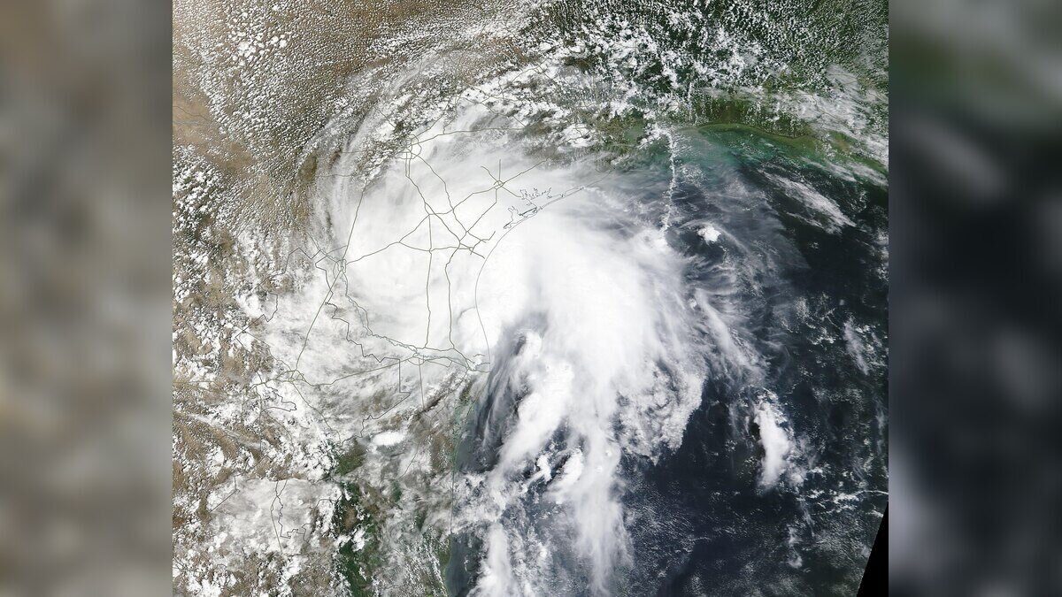
MIAMI — A tropical disturbance sitting just off Florida's coast has been tagged Invest 91L, and U.S. forecasters say its odds of becoming the Atlantic season's next depression or named storm are rising as it drifts slowly through the Gulf.
The rain, though, is not waiting for a name. Showers tied to the system were already dampening Tampa and stretches of Florida's northwestern coastline over the weekend, and the National Hurricane Center warns that heavy downpours will spread across parts of the state regardless of whether the system ever organizes.
For now, the Miami-based NHC gives 91L a low probability of formation within the next 48 hours. Beyond that window, the picture shifts: forecasters see medium chances of development across the coming week as the disturbance creeps north and northwest over warm Gulf waters — the basin U.S. agencies now call the Gulf of America, though much of the world still charts it as the Gulf of Mexico.
A slow mover with a long fuse
Invest 91L earned its designation on Saturday, but forecasters had their eyes on it earlier. On Friday, the NHC dropped an "X" on its tropical weather outlook map — the bureaucratic equivalent of a raised eyebrow — marking the disturbance as an official area of low pressure worth tracking.
Speed, or the lack of it, is the story here. The system is lumbering rather than racing, and slow-moving tropical systems tend to wring out extraordinary amounts of rain over the same zip codes for days. That is the scenario taking shape for Florida's Gulf-facing communities.
The hurricane center's advice is pointed: residents along the Florida panhandle, the state's western coast and neighboring coastal Alabama should keep close tabs on the system's progress. Not panic. Pay attention.
Rain first, questions later
FOX Weather meteorologist Jane Minar, tracking the system through the weekend, said the tropical development odds for 91L "continue to climb" as the disturbance consolidates off the Florida coast.
That framing matters for people on the ground. A disturbance does not need a closed circulation or a name from the 2026 storm list to flood a roadway or overwhelm a storm drain. The moisture plume feeding into Florida right now is proof — showers were reported in Tampa and along the northwestern coast before the system had even earned its invest tag.
Forecasters expect the heaviest downpours to track with the system's slow northward push in the days ahead.
What an "invest" actually means
The label confuses people every hurricane season, and the 2026 season will be no exception. An invest is not a storm, a depression or a warning. It is a filing system.
Each season, the hurricane center stamps the term on weather systems it wants to investigate for possible development into a tropical depression or tropical storm within a seven-day window. The naming convention is rigid: a number from 90 to 99, recycled as needed, paired with a letter marking the ocean basin. "L" covers the Atlantic. "E" and "C" go to the Eastern and Central Pacific.
So Invest 91L is simply the first Atlantic system in the current rotation of numbers to draw formal scrutiny — an official signal that forecasters are feeding the disturbance extra data and running it through specialized forecast models.
The machinery now watching the Gulf
That scrutiny has a technological backbone. Once a system earns an invest tag, it moves from background monitoring to targeted observation: geostationary satellites lock onto its cloud structure, ocean-observing instruments gauge how warm the water beneath it runs, and computer models begin spinning out track and intensity scenarios several times a day.
Warm Gulf water in mid-July is rarely a limiting factor. The sea surface in midsummer holds more than enough heat to fuel tropical development, which is why the seven-day forecast carries meaningfully higher odds than the next 48 hours. What the system needs is time over water and breathing room from disruptive winds aloft — and its sluggish pace may grant it both.
When disturbances edge close to land, the NHC can also task reconnaissance aircraft — the famed Hurricane Hunters — to fly directly into the weather and sample pressure, wind and moisture. Those flights often make the difference between a guess and a measurement.
The season's wider rhythm
The Atlantic hurricane season officially runs from June through November, with the statistical peak still weeks away in late summer. July systems in the Gulf are hardly unusual; the basin's bathwater-warm shallows have incubated quick-developing storms in past seasons, catching coastal residents off guard precisely because they form so close to home.
For international readers tracking the 2026 season, 91L is an early test of the machinery — and a reminder that the Gulf's proximity to densely populated coastlines compresses warning times in ways open-ocean storms do not. A system that spins up in the Caribbean may offer a week of runway. One that organizes 100 miles off Tampa offers days. Sometimes hours.
The NHC will issue fresh tropical weather outlooks on the system at regular intervals through the week, updating the development probabilities as new satellite and model data arrive. Emergency managers in Florida and Alabama routinely use those outlooks to pre-position resources long before any watch or warning is posted.
For now, the advice from forecasters is unglamorous and unchanged: watch the updates, not the sky. The most telling detail of the weekend may be the simplest one — rain from a nameless swirl of low pressure was falling on Tampa before the system even had a number.