Three hurricanes spin in the Pacific as El Niño drives a rare burst of storm activity
Hurricanes are churning in the Pacific Ocean at once, and forecasters say the cluster fits the pattern of an El Niño year. The timing. Three — full details…
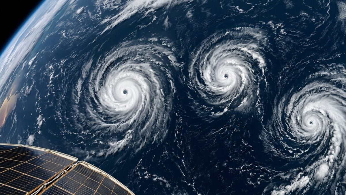
Three hurricanes are churning in the Pacific Ocean at once, and forecasters say the cluster fits the pattern of an El Niño year. The timing matters. One of the storms, Lowell, is now being watched for a possible turn toward Hawaii this weekend.
Lowell briefly surged to Category 5 strength on Wednesday before weakening to Category 3, according to the National Hurricane Center. It was moving west, then expected to bend sharply north over the weekend and pass near Oahu and Kauai. Marine traffic, island communities and emergency planners will be watching closely.
Fast-moving season.
Karina and Marie complete the unusual trio. Karina weakened from Category 3 to Category 2 east of the Hawaiian Islands and was forecast to weaken further over the next 48 hours. Marie sat over the open Pacific as the third named hurricane in the basin. The National Hurricane Center said Marie and Karina were not expected to bring impacts and should stay in open waters, while Lowell carried the most immediate uncertainty.
Why El Niño matters
Climate scientists say the storm pattern is in step with El Niño, the warming of the eastern Pacific that can help feed hurricane development in that part of the ocean. NASA said warming in the eastern Pacific has created conditions for more storms to form in 2026, and described Lowell, Karina and Marie in satellite imagery gathered on September 2. NASA also noted that the last time three hurricanes were active at the same time in the eastern or central Pacific was during another El Niño year, in 2015.
The numbers help explain why this stands out. On average, the Pacific sees about eight hurricanes a year, according to the National Hurricane Center. Having three at once is unusual, even if it has happened before. In 2015, Hurricanes Kilo, Ignacio and Jimena were also spinning in the basin together, and all three became major Category 4 storms.
Hawaii faces another close look
The forecast arrives while Hawaii is still cleaning up from a string of heavy rain and flash flooding events over the last six months. Just weeks ago, parts of Oahu and the Big Island took hits from Tropical Storm Lala, with intense flooding and strong winds. Damage also lingers from severe March flooding, when some parts of Oahu saw more than 25 inches of rain and parts of Maui got more than 19 inches.
That backdrop gives Lowell’s projected path extra weight. A shift north could put the storm near Oahu and Kauai, two islands that have already spent months dealing with water damage and unstable ground. The forecast remains uncertain. So does the coastline’s breathing room.
For now, the Pacific is carrying the load while the Atlantic stays unusually quiet. The Guardian reported that the Atlantic has yet to see a hurricane this season, a rare stretch that puts pressure on the record for the latest first Atlantic hurricane formation. But in the Pacific, the message is already clear: El Niño is making its presence felt, and the storm track is busy.
“The forecast comes as Hawaii is still recovering,” the National Hurricane Center said in its discussion of Lowell’s path.