Saildrone Explorer Crosses Hurricane Isaias’ Eye in 65-Foot Waves
A Saildrone Explorer crossed Hurricane Isaias about 150 nautical miles south of Pensacola, recording gusts over 103 mph and waves up to 65 feet, according to…
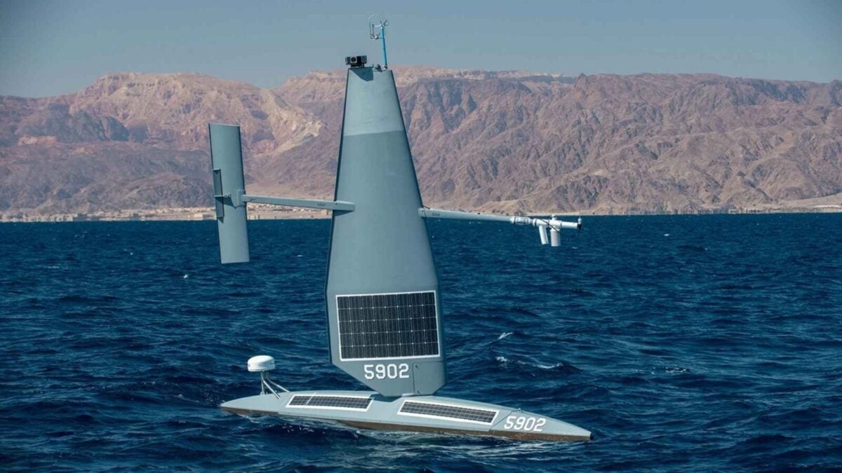
A 23-foot Saildrone Explorer entered Hurricane Isaias on October 9, when the storm was about 150 nautical miles south of Pensacola. The uncrewed vessel crossed the eye and emerged through waves up to 65 feet, gathering readings from inside the storm as pilots steered it from California.
The company said the boat recorded wind gusts over 103 mph. Its data targets conditions at the ocean surface, where heat and moisture move between sea and storm—an area that aircraft and satellites do not measure as directly.
It came through floating.
Two Saildrones took different routes
Saildrone pilots worked from a control room in Alameda, California, and directed SD-1045 toward the storm’s northern edge. A second vessel, SD-1057, took the eastern side of Isaias roughly 170 nautical miles west of Sarasota, according to the company.
The 65-foot waves were up to three times the Explorer’s 23-foot length. The vessel reportedly weighs around 1,500 pounds and cruises at one to three knots. For the hurricane mission, Saildrone replaced its standard tall wing with a shorter, reinforced one.
Richard Jenkins, the company’s founder, described why the shorter wing helps in high winds. “It reduces weight, the center of gravity is lower,” he told the Boston Globe. The storm configuration is fitted before deployment, rather than changed while the vessel is at sea.
The Explorer uses a rigid wing to catch wind and solar panels on the wing and deck to power its electronics. It has no engine, fuel or cabin. The standard wing stands 15 feet tall, and the vessel can remain at sea for a year or more without anyone touching it, according to the source.
Surface readings are the target
Hurricane Hunter aircraft fly through storms and drop sensors by parachute, while satellites observe cloud tops. Saildrones can collect measurements closer to the sea surface, where the exchange of heat and moisture can influence a storm’s strength.
That distinction matters for forecasting rapid intensification. The source cites the National Oceanic and Atmospheric Administration’s definition as an increase of at least 35 mph in sustained winds within 24 hours. It says Isaias gained 35 mph in under 24 hours on its way toward the Florida Panhandle.
Isaias reached the coast that night. The National Hurricane Center had the storm at 120 mph and Category 3 on Friday morning; by evening, wind shear and the coast had reduced it to Category 2. The hurricane came ashore near Destin, Florida, at about 9:30 p.m. ET, with sustained winds of 105 mph and pressure of 971 millibars, according to a weather.com recap cited by the source.
A gust of 116 mph was recorded at Santa Rosa Sound. Around 700,000 customers lost power across the Panhandle, and two people died, the source reported.
The measurements from the uncrewed boats add observations from a part of the storm that is difficult to monitor directly. SD-1045 crossed the eye and recorded waves up to 65 feet.
Source: autonocion.com