KwaZulu-Natal Braces for Cold, Windy Weekend as Damaging Gusts Sweep In
Residents in parts of KwaZulu-Natal are heading into a cold, windy weekend after the South African Weather Service warned that strong winds, isolated showers...
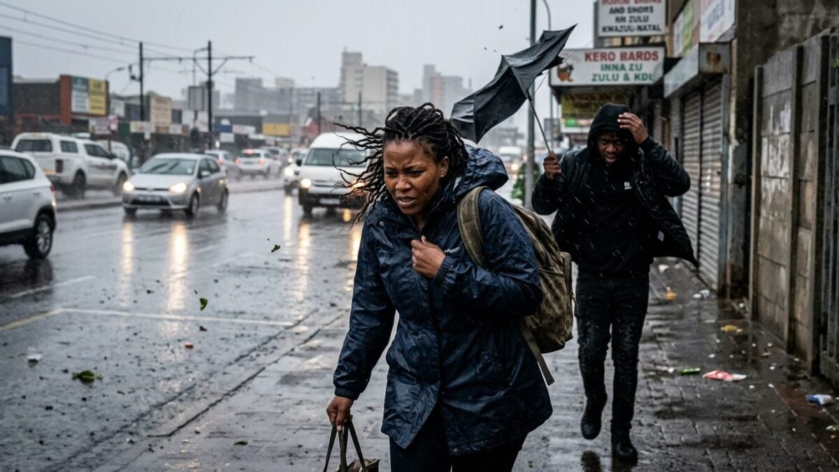
Residents in parts of KwaZulu-Natal are heading into a cold, windy weekend after the South African Weather Service warned that strong winds, isolated showers and rain will sweep across the province from Friday. The alert comes with a Yellow Level 2 warning for damaging winds, a signal that conditions could turn rough fast.
Winds are expected to reach about 40km/h, with gusts rising to 80km/h. That may sound brief on paper. On the ground, it can mean blown debris, difficult driving and sudden disruptions for boats, ports and road users caught out in exposed areas.
Cold front drives the shift
SAWS said the warning follows the passage of a cold front, backed by a ridging high-pressure system. The weather pattern is set to push colder air and strong gusts across the province, tightening conditions after a calmer spell.
The agency urged members of the public and motorists to stay vigilant during the period. Trees brought down by the wind could block roads. High-sided vehicles may struggle on exposed roads, high-level routes and bridges. That raises the risk of delays and, in some places, sudden stops.
Maritime risks also grow
The warning is not limited to land travel. SAWS said the strong winds could put small vessels at risk, with boats potentially taking on water or capsizing. Small harbours and ports may also face temporary disruption as the weather turns more unsettled.
For coastal communities and operators, that means keeping a close eye on changing sea and wind conditions. Small craft are the most exposed in conditions like these, especially when gusts build quickly and visibility drops during showers.
Travel and daily movement under pressure
The effects could ripple beyond the coast. Transport routes and travel services may also feel the strain where strong winds bring down trees or make crossings hazardous. The weather service did not single out every affected route, but the warning is broad enough to cover a range of everyday movement across the province.
For drivers, the advice is simple: slow down, stay alert and avoid taking chances on open stretches where the wind can hit hardest. For those heading to ports, beaches or waterways, the risk is sharper. The cold front may move through quickly, but the disruption it leaves behind could linger into the weekend.
KwaZulu-Natal is not the only part of South Africa feeling the impact of the system. SAWS separately noted freezing conditions for Gauteng as the same cold front moved across the country, underlining how widely the weather pattern is being felt. In KwaZulu-Natal, the most immediate concern now is the combination of wind, rain and the kind of sudden gusts that can turn an ordinary trip into a problem before noon.
SAWS said the damaging-wind warning takes effect from Friday, and residents in exposed areas will be watching closely to see how hard the front bites as the weekend unfolds.