23-Foot Drone Sailboat Begins Solo Antarctica Carbon Survey
A Saildrone Explorer departed Tasmania to circle Antarctica without a crew, carrying a sensor to measure carbon dioxide moving between the Southern Ocean and…
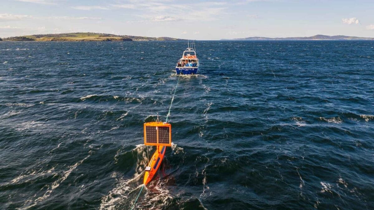
A Saildrone Explorer left Tasmania on September 20 to circle Antarctica alone, carrying sensors to measure carbon dioxide moving between the ocean and the atmosphere. The 23-foot drone sailboat left Storm Bay, south of Hobart, and its operator expects the voyage to take about 200 days and cover more than 13,000 miles.
The uncrewed vessel is designed to collect observations in the Southern Ocean, including during winter conditions that have kept traditional research ships from making measurements there, according to the source report. Those readings could help researchers understand how much carbon the ocean absorbs or releases.
Saildrone Explorer SD-1092 has no crew or engine. It moves using a rigid wing, while solar panels power its electronics. Its central instrument is a sensor built by the National Oceanic and Atmospheric Administration (NOAA), which measures carbon dioxide pressure in the air and water.
The conditions turned rough within days. Saildrone, the California company that builds and operates the boats, reported winds of up to 50 knots and waves over 26 feet. An engineer involved in the deployment posted an onboard camera image from September 21 showing 35-knot gusts and a significant wave height of 22 feet.
Why the 23-foot drone sailboat is measuring carbon
The sensor compares the pressure of carbon dioxide on the air and water sides. If the water-side pressure is higher, the ocean is releasing carbon dioxide into the atmosphere; if the air-side pressure is higher, the ocean is absorbing it, according to the report.
The distinction matters because the Southern Ocean’s role in the global carbon cycle remains uncertain. The report cites NOAA estimates that the ocean absorbs about a third of the carbon dioxide people release into the air each year, while the Southern Ocean handles about 40 percent of that ocean uptake. It says researchers remain uncertain about the estimates, one reason the voyage is collecting direct measurements.
Getting those measurements is difficult. The Southern Ocean is shaped by the Antarctic Circumpolar Current, which flows around Antarctica and brings deep water to the surface while pushing surface water downward. Research ships visit during summer, but NOAA’s Adrienne Sutton, a co-leader of the project, said traditional tools have not been able to make observations there in winter.
That gap has consequences for climate research: if models treat the Southern Ocean as consistently absorbing carbon, they may miss periods when deep water brings older carbon dioxide to the surface and releases it into the air. The source report says an earlier Saildrone voyage provided direct surface measurements of this exchange through a Southern Ocean winter.
An earlier voyage tested the design
The current mission follows an earlier attempt. Saildrone Explorer SD-1020 departed Bluff, New Zealand, on January 19, 2019, and returned on August 3 after 196 days and 11,879 nautical miles, according to the report. Saildrone said it encountered 50-foot waves, 80-mph winds and collisions with icebergs.
Saildrone had sent two boats on that earlier trip. The conventional wing on one was damaged in the first storms, while the vessel that continued used a square-rigged wing designed for the expedition. The new voyage is now testing a similar challenge: keeping instruments operating while the boat crosses remote waters in severe weather.
The operator expects SD-1092 to continue around Antarctica for about 200 days, covering more than 13,000 miles before the mission’s planned sensor exchange.
Source: autonocion.com