Indonesia Early Weather Warning for June 22-24, 2026 Hits 27 Provinces
Indonesia early weather warning covers 27 provinces, with heavy rain, strong winds, and higher-risk areas in three provinces.
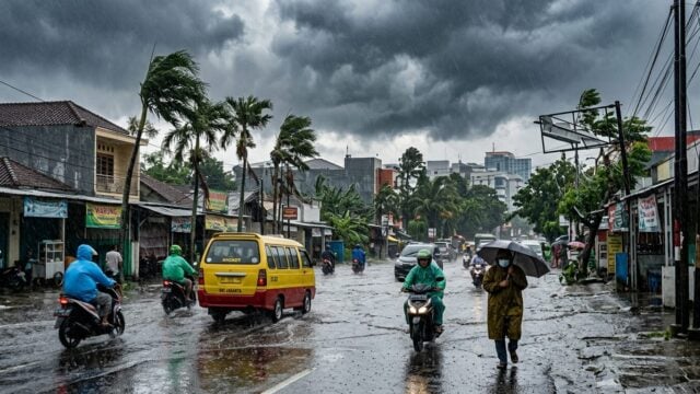
JAKARTA — Indonesia Early Weather Warning for June 22-24, 2026 Covers 27 Provinces, with the Meteorology, Climatology and Geophysics Agency, known as BMKG, warning of heavy rain, thunderstorms and strong winds across much of the country. The agency said the highest alert level applies to the western part of West Sumatra, Bengkulu and Highland Papua.
The warning, released Monday, June 22, 2026 at 07:00 WIB, raises the risk of flooding, landslides, falling trees and shipping disruption starting immediately. For people living on riverbanks, hillsides and coastal routes, the next three days could bring fast-changing conditions.
What is driving the weather pattern
BMKG said three large-scale weather factors are shaping the forecast: an active Asian monsoon, wind convergence in several areas and a sharp rise in atmospheric instability. In plain terms, the air is primed to build thick rain clouds over many parts of the country at the same time.
That combination matters because it can lock in heavy rainfall over the same area for hours. BMKG said the provinces at alert level could see rain above 150 mm per day on June 23-24, a level that can overwhelm drainage systems and trigger landslides on steep terrain.
“People in flood-prone and landslide-prone areas need to stay alert and follow the latest BMKG updates,” a BMKG official said, referring to the agency’s routine public advisories for severe weather.
27 provinces face rain, thunder and strong winds
BMKG mapped 27 provinces at alert level for moderate to heavy rain accompanied by lightning and strong winds over the three-day period. The list covers nearly every major island group, from Sumatra and Java to Kalimantan, Sulawesi, Maluku and Papua.
In Sumatra, the warning stretches across Aceh, North Sumatra, Riau, Riau Islands, Jambi, Bengkulu, Lampung, Bangka Belitung and South Sumatra, with South Sumatra starting June 23. On Java, Jakarta gets a special warning for the afternoon and evening of June 23, while West Java is covered for all three days. Central Java, Yogyakarta and East Java fall under the warning on June 23-24.
Kalimantan and Sulawesi are also in the risk zone. West, Central and East Kalimantan are covered from June 22-24, while North, Central and Southeast Sulawesi face the same three-day alert. Maluku, West Papua and Papua are also included. The agency also placed Bali under alert for June 23-24, adding pressure on a province that depends heavily on tourism and transport links.
| Province | Alert period | Level |
|---|---|---|
| Aceh | June 22-24 | Alert |
| West Sumatra (western part) | June 23-24 | Warning |
| Bengkulu | June 22-24 / June 23-24 | Warning |
| Jakarta | June 23 afternoon-evening | Alert |
| West Java | June 22-24 | Alert |
| Bali | June 23-24 | Alert |
| Highland Papua | June 23-24 | Warning |
| Papua | June 22-24 | Alert |
Strong winds and dangerous seas
BMKG said winds of 25-40 km/h may hit the western coast of Sumatra from Aceh to Lampung, the southern coast of Java from Banten to East Java, and coastal areas in Kalimantan and Sulawesi. Those gusts can topple weak trees, hamper road travel and make small boats harder to control.
Open waters could also turn rough. Waves in the North Natuna Sea, the Sulawesi Sea and the Indian Ocean south of Java may reach 2-4 meters, a range that raises the danger for fishing boats, inter-island ferries and other small vessels. For passengers and crews, that means one thing: check before you go.
This is the part that affects people far beyond the weather map. Farmers need to watch for waterlogged fields. Urban commuters may face slower roads and short-notice transport delays. Fishers can lose a day at sea. In coastal provinces, a strong wind warning often changes school runs, ferry schedules and market deliveries before noon.
Palembang forecast and what residents should do
In Palembang, South Sumatra, BMKG forecasts light rain on June 22 with temperatures of 24-32°C and humidity of 75-95%. Moderate rain is expected in the afternoon on June 23, with temperatures easing to 23-31°C. On June 24, skies are forecast to be mostly cloudy with potential rain and temperatures returning to 24-32°C.
BMKG told residents living along riverbanks and on hillsides to move to safer ground immediately if heavy rain lasts more than one hour without easing. The agency also urged the public to keep checking the latest forecast before traveling, especially on routes prone to flooding, landslides or falling branches.
Weather conditions can change quickly, and BMKG said the warning should be treated as a live update, not a one-time notice. The next agency bulletin will determine whether the alert expands, holds steady or starts to ease.