Wildfires Devour Over 3,400 Hectares in Indonesia's Kapuas Region
Forest fires have consumed 3,434.12 hectares in Indonesia's Kapuas district through September 2026, raising urgent health and environmental concerns.
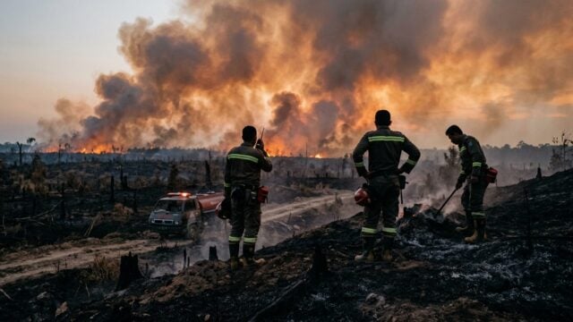
KUALA KAPUAS, Indonesia — Forest and land fires have decimated 3,434.12 hectares across the Kapuas district in Central Kalimantan, Indonesia, between January and September 2026. The scale of the destruction is vast, covering an area roughly equivalent to 4,800 football pitches, according to data from the local disaster mitigation task force.
Official reports from the Drought and Forest Fire Emergency Response Task Force confirm a total of 352 individual blaze incidents during the nine-month period. This frequency, averaging nearly one fire per day, highlights a persistent failure in containment strategies for the resource-rich region. "This indicates that our prevention systems are not yet optimal," stated Pangeran S. Pandiangan, head of the Kapuas Disaster Management Agency (BPBD).
Mantangai District Becomes Ground Zero
The district of Mantangai has emerged as the worst-affected area, accounting for 1,903.15 hectares of the total damage—more than half of the district-wide figure. Other significantly impacted zones include Dadahup, which reported 309.9 hectares lost, East Kapuas with 196.5 hectares, and Kapuas Murung with 146.3 hectares. While many areas suffer, the municipalities of Kapuas Kuala and Tamban Catur remain the only zones to avoid recorded fire damage through the end of September.
Satellite Data Reveals Surge in Heat Sources
Satellite monitoring systems recorded 30,200 thermal hotspots across Kapuas during the first three quarters of the year. Data shows a concerning upward trend as the dry season persists; hotspots increased from 14,789 in August to 14,816 in September. Mantangai remains the primary source of these heat signals, logging 7,589 hotspots in September alone, followed by Timpah with 2,331 and Dadahup with 566. These metrics suggest that human activity—ranging from intentional clearing to negligence—continues to drive the wildfire crisis as the third quarter concludes.
Human and Environmental Toll
The crisis extends beyond mere land loss. Thousands of residents are currently facing severe health risks from thick smoke, which poses particular dangers to children and the elderly. The deteriorating air quality has frequently disrupted schools and economic productivity. Furthermore, the destruction of both protected forests and agricultural land threatens local biodiversity and the long-term economic stability of the region.
Challenges in Containment Efforts
The Kapuas Disaster Management Agency continues to coordinate with local forestry departments, military, and police forces to conduct daily patrols and real-time monitoring. However, responders face formidable obstacles, including limited access to remote terrain and the difficulty of prosecuting those responsible for intentional burns. With vegetation remaining tinder-dry due to the prolonged dry season, authorities warn that total fire damage for 2026 could surpass previous records unless the weather pattern shifts.
"We hope the people of Kapuas will become partners in prevention—do not burn land, report suspicious activity, and maintain soil humidity," Pangeran S. Pandiangan urged.