Antarctica Yields Evidence of Ancient Himalaya-Sized Mountains
Researchers have identified the buried roots of ancient mountain ranges beneath Antarctica’s ice sheet. An analysis of 1,712 zircon crystals suggests the ranges formed as Gondwana assembled, and their erosion may have helped create conditions for complex life.
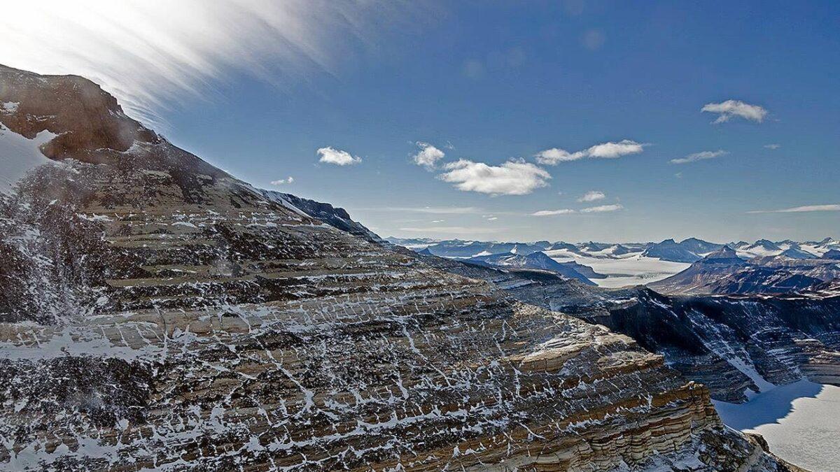
Researchers have found evidence of ancient Himalaya-sized supermountains beneath Antarctica’s ice sheet by analyzing 1,712 mineral grains. The buried roots point to mountain ranges that formed between 650 and 450 million years ago, when the Gondwana supercontinent assembled.
The findings offer a possible explanation for changes in Earth’s environment that accompanied the emergence of complex life. The mountains have eroded, leaving roots buried beneath the ice rather than intact peaks.
Scientists from the Australian National University and Germany’s GFZ Research Centre for Geosciences published the study in Earth and Planetary Science Letters. They concluded that the ranges formed when Antarctica collided with India and Africa.
Ocean sediments revealed buried roots
More than 99.5 percent of Antarctica is covered by a thick ice sheet. Instead of examining the buried rocks directly, the researchers studied sediments recovered through ocean drilling along the continent’s margin.
The team examined tiny crystals of zircon, a mineral that preserves evidence of the conditions and time of its formation. The grains helped researchers determine the age and chemical composition of their original rocks.
That evidence allowed the scientists to infer the geological processes that formed the rocks and identify the deeply buried roots of the ancient ranges. The researchers describe the collision as the largest mountain-building event to have affected Antarctica.
Zircon can preserve its original structure for billions of years, despite erosion, high temperatures and pressure. Researchers can date it by measuring uranium and lead within the crystals.
When zircon crystallizes, it incorporates uranium but excludes lead. Uranium then decays into lead at known rates, allowing scientists to calculate how long ago the crystal formed.
Erosion may have supported early life
Ian Campbell, an emeritus professor at the Australian National University and study co-author, said rapid erosion of the mountains played a key role in life’s development. Weathering delivered nutrients to the oceans, lowered atmospheric carbon dioxide and increased oxygen concentrations, he said.
Those changes created conditions for the first organisms with hard skeletons, which appeared 539 million years ago, Campbell said. They also preceded a sudden increase in animal diversity known as the Cambrian explosion.
Separate map exposed hidden terrain
A separate Antarctic map published in Science in January 2026 identified 71,997 previously unknown hills beneath the ice. Researchers combined high-resolution satellite images with equations describing glacier movement to reveal landforms between 2 and 30 kilometres in size.
The map also showed sharp ridges and deep valleys. In the Maud Subglacial Basin, researchers identified a steep-sided channel almost 400 kilometres long, six kilometres wide and 50 metres deep.
 Take the quizWhat Kind of Holiday Spender Are You? Take the Black Friday QuizStart →



 Markets · FintechHow to Calculate Compound Interest: Formula, Examples and the Rule of 72
 Lifestyle · Food & HealthNormal Blood Pressure Chart by Age: Healthy Ranges Explained
 Lifestyle · Food & HealthWhat Is Raynaud’s Syndrome? Why Fingers Turn White in the Cold
 Lifestyle · Food & Health4 Ways Walking After Meals Helps Your Body, Doctors Say